Advertisement
Govt identifies landslide-prone areas in Murang’a county
Monday 16th March, 2026 05:23 PM|
The Ministry of Interior and National Administration has issued a report on the areas affected by landslides in Murang’a County.
In a statement by the Ministry on the official X account on Monday, March 16, 2026, the Ministry visited the affected areas with a team of experts from the Ministry of Mining.
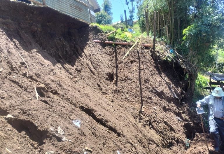
According to a report, the Ministry has confirmed that the areas affected by landslides are in Kiruri Location, Kangema Sub-County.
On the other hand, the experts’ reports reveal that the landslides in the area are due to weak soil structure and decomposing tree roots that create underground air spaces.
You Might Also Like


In addition, reports indicate that landslides were also attributed to poor rainwater management, which increases soil erosion during heavy rains.
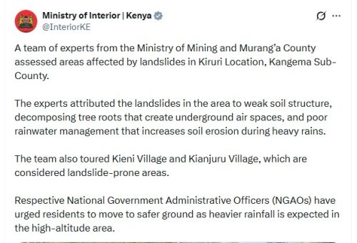
“A team of experts from the Ministry of Mining and Murang’a County assessed areas affected by landslides in Kiruri Location, Kangema Sub-County. The experts attributed the landslides in the area to weak soil structure, decomposing tree roots that create underground air spaces, and poor rainwater management that increases soil erosion during heavy rains,” part of the Ministry’s X post reads.
“The team also toured Kieni Village and Kianjuru Village, which are considered landslide-prone areas. Respective National Government Administrative Officers (NGAOs) have urged residents to move to safer ground as heavier rainfall is expected in the high-altitude area,” the Ministry added.
Flooding reports
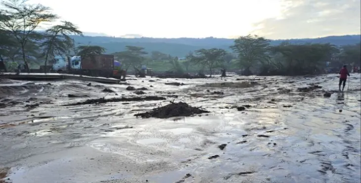
The landslide reports come days after the Ministry confirmed the death toll from devastating floods sweeping across Kenya
According to the Ministry, the death toll has risen to 62, with thousands more displaced, as heavy rainfall continues to batter parts of the country during the early long rains season.
The National Disaster Management Unit, under the Ministry of Interior and National Administration, confirmed the fatalities on March 14, 2026.
Among those killed are 46 men, 8 women, and 8 children. Nairobi recorded the highest number of deaths at 33, followed by the Eastern region with 17 and Rift Valley with 7. Smaller numbers were reported in Nyanza and Coast regions (2 each) and the Central region (1).
“The National Disaster Management Unit has confirmed the number of fatalities from floods has risen to 62, including 46 men, 8 women, and 8 children,” part of the Ministry’s X post reads.
Widespread displacement and infrastructure damage
Floods have affected 18 counties, including Nairobi, Kisumu, Narok, Kiambu, Migori, Siaya, Makueni, Busia, Wajir, Kilifi, Homa Bay, Taita Taveta, Baringo, Kajiado, Kwale, Machakos, and Kericho.
Official figures indicate that 12,338 people are displaced and 8 homes are damaged. However, the actual impact is expected to be far greater, with numerous residential areas flooded, farms destroyed, and markets and businesses submerged.
Infrastructure has been severely affected. Impassable roads and damaged bridges have isolated communities, while power outages and disrupted water supply lines have compounded hardships.
Schools in the affected areas have also been disrupted, affecting thousands of students. Rescue operations continue, with nine people still reported missing as teams work to locate survivors and recover bodies.
Author
Latest News


Advertisement
More on News