Advertisement
What Marakwet’s landslide teaches Kenya about risk management
Sunday 02nd November, 2025 08:38 PM|

The landslide that struck Marakwet East in Elgeyo Marakwet County on November 1, 2025, highlights Kenya’s vulnerability to natural hazards exacerbated by environmental degradation.
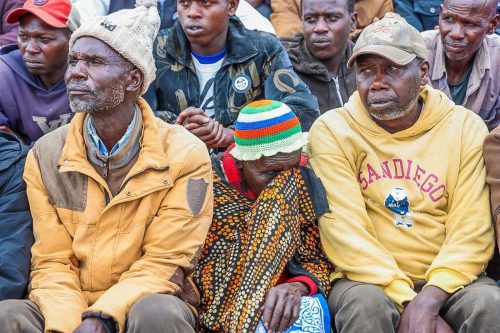
Triggered by heavy overnight rains during the short rainy season, the disaster buried homes under mud and debris, sweeping away entire families in villages such as Chesongoch, Kamoko, and Moror.
By November 2, 2025, officials confirmed 26 people dead, 25 still missing, and 26 hospitalised, mostly at Moi Teaching and Referral Hospital (MTRH) in Eldoret.
Interior Cabinet Secretary Kipchumba Murkomen noted that most victims were from a single extended family in Endo Ward, where 19 lives were lost, highlighting the concentrated grief in close-knit communities.
You Might Also Like


Also watch: Government swiftly responds to Marakwet landslide, assures support to affected families..
Causes and contributing factors
Heavy rainfall, characteristic of Kenya’s bimodal seasons, was the immediate trigger. Saturated steep escarpment slopes in the Rift Valley caused flash floods and mudslides.
Murkomen attributed the scale of destruction to years of unchecked deforestation and unsustainable farming practices, which stripped slopes of stabilising vegetation. The highland topography, with slopes exceeding 25–30 degrees in many areas, further exacerbated the risk.
Other contributing factors include:
- Overgrazing and overfarming
- Slope excavation for housing
- Population pressure and limited relocation options
Kenya has lost over 5,700 hectares of forest annually since 1990, according to the 2017 National Disaster Risk Management Policy. Landslides frequently occur in the Aberdare Ranges and Rift Valley, where porous soils expand and collapse when saturated.
Response and the path forward
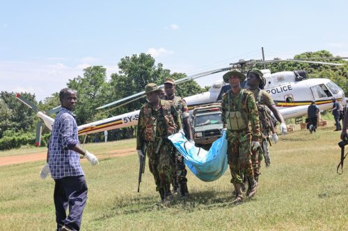
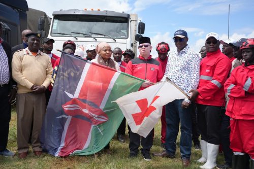
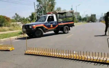
Kenya’s disaster response demonstrated coordination but also exposed gaps in preventive planning. Multi-agency teams, including the Kenya Defence Forces, National Police Service, National Youth Service, Kenya Red Cross, and local authorities, mobilised swiftly.
Four helicopters and one fixed-wing aircraft airlifted survivors and victims, while drones assisted in damage assessments. Relief items distributed included 600 bags of rice, 520 bags of beans, 1,000 blankets, and 300 mattresses to over 1,000 displaced households. Roads blocked by debris are being cleared, and electricity restoration is underway under the Kenya Rural Roads Authority (KeRRA).
Government Spokesperson Isaac Mwaura emphasised psychosocial support and tracing efforts for the missing, urging national solidarity. President William Ruto assured full state backing, covering hospital bills and funeral costs.
The disaster also disrupted KCSE exams and damaged roads linking Marakwet East to neighbouring counties. Economically, landslides cost an estimated 2–2.4 per cent of Kenya’s GDP annually.
National Treasury Principal Secretary Chris Kiptoo, after visiting the site, called for preventive measures, noting: “This tragedy highlights the increasing risks faced by communities in escarpment and flood-prone areas.”
Studies identify steep topography, weathered soils, and human activity as key risk factors. Climate change is projected to increase landslide frequency in the Rift Valley by 20–30 per cent by 2050.
To reduce future risks, the government should consider:
- Implementing environmental restoration and afforestation in high-risk zones
- Enforcing sustainable land-use planning and building codes informed by geotechnical studies
- Zoning areas based on slope angle, elevation, vegetation cover, and proximity to waterways
- Establishing early warning systems integrated with the National Disaster Operations Centre
- Educating communities on evacuation procedures and disaster preparedness
- Prioritising fiscal allocations toward resilience-building rather than reactive recovery
As search teams continue amid ongoing rains, the Marakwet East landslide underscores the urgent need for Kenya to evolve from crisis response to foresight.
Collective action in hazard mapping, ecosystem restoration, and community empowerment can help turn vulnerability into vigilance, safeguarding lives and livelihoods for the future.
Author
Latest News


Advertisement
More on Insights