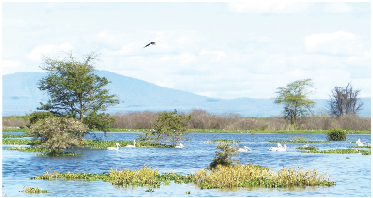
Government starts survey of Lake Naivasha to kick out encroachers

Kirera Mwiti
@PeopleDailyKe
The Sate has embarked on an exercise to mark the boundaries of Lake Naivasha. Department of Survey’s move comes in the wake of massive encroachment of the riparian land and closure of access corridors by individuals and institutions.
The delimitation will establish the current contours and create a hydrographic infrastructure by establishing horizontal and vertical bench marks around the lake and its environs.
It is being done at a time when private institutions and unscrupulous traders have encroached on the riparian land in recent years.
A notice signed by acting director survey Maritim Weldon says the exercise would include staking out the 1892.8m Above Sea Level contour line that defines the lake.
“The surveyors will thereafter erect short pillars to define the line at an interval of 1km as part of the planned demarcation,” read the notice.
Naivasha Deputy County commissioner Mutua Kisulu said those who had encroached on riparian land would have to move out.
“The government through the department of survey has embarked on a demarcation exercise which is meant to identify the real boundaries of Lake Naivasha,” he said.
Mutua noted that already, tens of families which had been displaced by the rising waters of the lake around Kihoto estate had started to return.
The chairman Lake Naivasha Water Resource Users Association Enock Kiminta said the survey had come at the right time.
He, however, warned that the exercise should not be used as a witch-hunt adding that land was very emotive and could lead to legal and physical conflicts.
“We are calling on the government agency to incorporate all the stakeholders in this critical exercise which seeks to identify the real boundaries around this lake,” he said.


